Status: Done | Timeline: October 2018 - March 2019
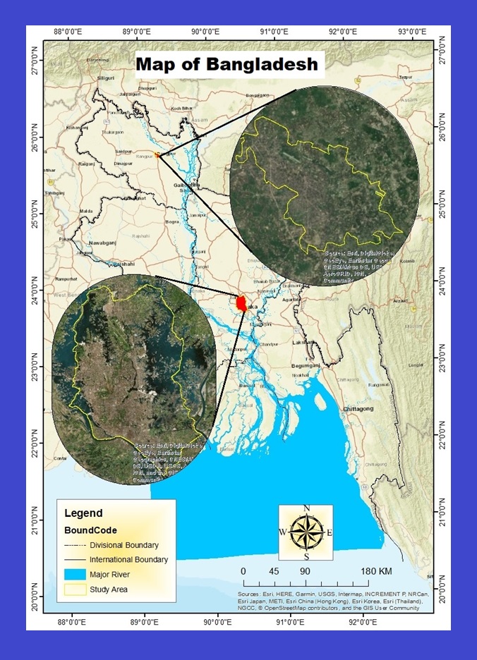
This study aims to quantify the decadal spatio-temporal climate and morphological scenarios in two major cities of Bangladesh—Dhaka and Rangpur—and to investigate climate change trends and their impacts on land cover. It also examines climate-related extreme events and their correlations with spatial and climatic variables. The study utilizes data from 1988 to 2017, obtained from the Bangladesh Meteorological Department (BMD) and USGS Earth Explorer, selected based on the cities' distinct climate and geographical conditions. Thirty years of data were analyzed for decadal, seasonal, and annual patterns. Climate trends and magnitudes were assessed using the Mann-Kendall trend test and Sen's slope methods, while a hybrid classification approach (supervised and unsupervised) was applied for decadal land use and land cover analysis.
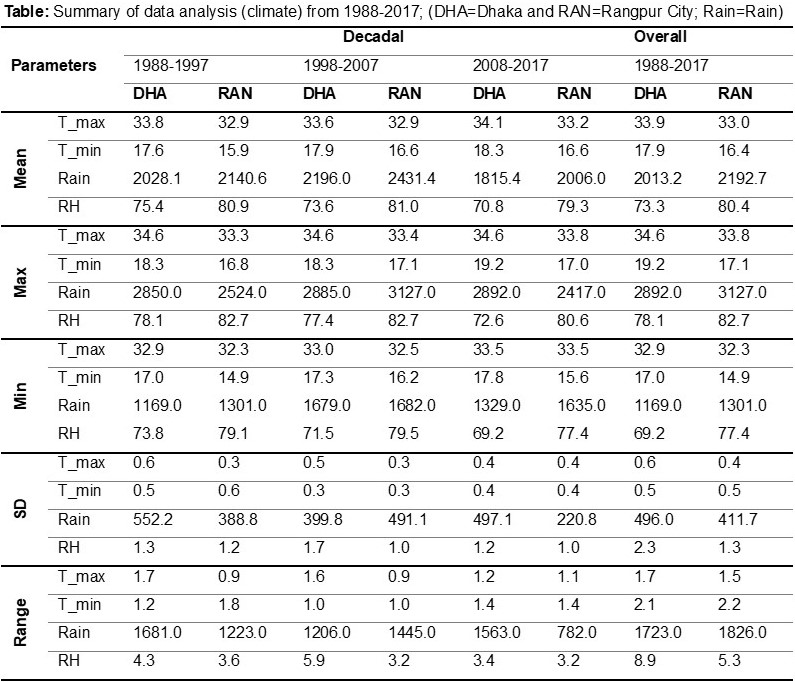
Pearson correlation coefficients were calculated to explore the relationships between climate variables and spatial features. The results indicate that annual maximum temperatures increased by 0.75°C in Dhaka and 0.57°C in Rangpur, while minimum temperatures rose by 0.81°C and 1.23°C, respectively, over the past 30 years. Both cities experienced a decline in annual rainfall, with reductions of 11.72 mm in Dhaka and 8.47 mm in Rangpur. Monsoonal rainfall decreased in Rangpur but increased in Dhaka, leading to issues such as waterlogging in the latter. Additionally, significant land cover changes were observed, influenced by urban expansion and climate shifts. These findings provide valuable insights for developing policies related to urbanization, sustainable development, land management, and climate change adaptation.